Showing posts with label mikeg. Show all posts
Showing posts with label mikeg. Show all posts
Monday, 3 September 2012
Summer Catch-up
With a major change of lifestyle occurring over the last couple of months - a new girlfriend (Jane), one-and-a-half extra children, new pets and new responsibilities - I've unfortunately had little chance to do any serious walking despite my new 'better half' loving it.
Here's a catch-up on what I, or we've been up to:
Tenerife
I had two weeks at the end of July in Tenerife where I basically sunbathed and ate continuously. Aside from four very early morning jogs I did very little else - even at 5am I'd have sweat running into my eyes it was so warm. However whilst there I picked up one solitary Geocache just to get one in that country; I actually walked by quite a few others but with the kids, the heat and the muggles I simply didn't have the interest to try harder.
Hope - 13/08/2012
Jane had a few days off so I also took the Monday and drove to Hope where I showed her the "Plummer Circular" - the walk I did back on 12/04/2012 with Chris from work. This is a ten mile walk up Win Hill, across to Hope Cross, down and up to Back Tor and Lose Hill. Jane even talked me into finding the cache on Back Tor that had been bugging me for ages because it was a fair way off the track - and this from someone who has absolutely zero interest in caching!
Messing about along the top from Win Hill to Hope Cross I was jokingly skipping with happiness (who says you have to grow up?) and I twisted my ankle (OK, my body's aged even if my brain hasn't) which spoiled the second half of the walk a bit, but aside from that we had a fabulous day out; perfect weather and perfect company.
Coxley Valley - 18/08/2012
Off to Overton for MikeG's Yorkshire International Geocaching event. It was good to meet everyone I'd not seen for ages and while we were there we did half of his new series; we bailed out after only doing a total of 3 miles as we had to get back in time for our allocated food time-slot.
A lovely afternoon, great food, fabulous weather and bountiful good company.
Wharncliffe Crags - 27/08/2012
Bank Holiday so we left all the kids we had at home to fuel their technology addictions and just took the dog on a long walk around both parts of Wharncliffe Woods & Crags. A great 9.3 mile walk with lots of chat and time to enjoy the views. Life doesn't get much better.
Froggatt Edge - 02/09/2012
Taking Jane to another place she's never visited we parked on the A625 and walked 6.1 miles anti-clockwise around Froggatt Edge. I knew I'd been here before but I didn't remember a second of it - likely because my last visit here was the first outing with Patrick and Donna and we probably talked the whole way round. We're doing ever so well with the weather lately and that, coupled with the great views and fresh air, make for yet another truly amazing day out with the most perfect companion I could hope for.


Tuesday, 9 August 2011
Helvellyn 10,000
Sunday 07/08/11 - 5am
Woken up from a fitful nights sleep by my phone alarm clock I set about making final preparations for the long day ahead. Four litres of water were stored in the backpack, sandwiches retrieved from the fridge, crisps, chocolate, celery and carrots added to the mix. I have to note that I'd already packed the suncream four days earlier after my last two long walks ended in sunburn.
I set off to meet StevieP near to where I work for 6am.
"Why the early start?" I hear you ask, "especially as you're typically a lazy sod on Sunday mornings."
"Well", says I, rising to defend myself and to stop this silly third-person speaking...
In similar style to the epic outing in March to Coniston, today we were all hoping to join StevieP as he bags his 10,000th cache atop Helvellyn in the Lake District. No small feat for him (over 9000 caches in front of me) and no small feat for me as Helvellyn is the second or third highest peak in England after Scafell Pike and Scafell - depending on your Marilyns and Hewitts. (See Wikipedia page on Helvellyn, also see Highest mountains in England.) It is approximately 500m taller than Coniston Old Man but more telling is it's prominence of 712m as opposed to 416m - this is a more accurate guide of how much work you have to put in to ascend to the summit.
6am
Pick up StevieP and drive up the M1 to Overton to meet MikeG. Get into his car and drive through Huddersfield to the M62 and pick up Paul 'Penfolio' at 7am.
7am-9am.
The long drive up to the Lake District was an enjoyable one swapping stories with the guys who I've not seen for a few months. We also picked up a couple of driveby caches on the motorway and then the A591 so that Steve had some leeway should we get any DNFs later in the day - it's a tricky business trying to ensure that your 10,000th cache is a specific one! As we then hit the smaller roads we also picked up another couple of caches on the A592 close to our destination - Glenridding which is on the south end of Ullswater.
9:30am - 160 metres - our starting altitude
Having now met up with Mr Truffles, KevW, and his two children 'The Penguin Boys', we set off west and I was soon wheezing away and feeling as though my heart wanted to go home already. The short steep climb to the first cache would originally have been a bad omen but I've now become used to the fact that each day my walking starts with tired legs, a pounding heart and lungs that seem painfully inadequate yet I know that this eases away after about 45 minutes as my body loosens up. My rucksack is extra heavy today with 2 litres of extra water (i.e. 2kg extra weight) and also enough food for two stops rather than the typical one. Thankfully I'm assisted by the cool damp weather. Incidently there had been terrible rain the day before and we were on rain alert today too - looks like I'm carrying the suncream for no reason!
The first cache was found quickly by main man StevieP but we notice that the puzzle coordinates inside are missing. Fortunately the cache these refer to is located after his planned 10,000th so missing it won't affect him.
We then headed along the hillside on a gentle climb before a quick 20m rise at the end (to 250m) to find another cache - Glenridding Saunter 1 - a puzzle nicely worked out the day before by KevW. A simple hide that stumped both Mr Truffles and StevieP before I walked up and instantly put my hand on it - just one of those strange random things but I was pleased I did as I think it was my only find of the day.
A long gentle walk up a track to arrive at Glenridding Saunter 2 (again pre-solved by KevW) for 10:30 at an altitude of 340m. This was the last cache of the day in any series - all the rest were unrelated standalone caches.
Following a path further up we stopped for another cache just where Red Tarn Beck joins with Glenridding Beck at about 420m before all splitting up while each planning a route across the stream so we could ascend Raise - our first major summit of the day.
I'd wandered off with MikeG and we found a good place to cross but I still managed to dunk my right leg in the water. A cold shock but in hindsight I think it was 95% temperature drop and only 5% water leakage over the top of my boots - thankfully. I'm no expert but I suspect wet feet would make for an highly unpleasant walk and blisters.
From the stream level of 400m we had a short, sharp and tough scramble up to 440m before joining a track and then a steady walk to 500m over the next 15 minutes and then the climb started in earnest.

Scrambling up the hillside in the absence of a path
11:30am
Over the next 45 minutes I zigzagged a walking mile up the hill, rising to a whopping 810m; I just put my head down and simply placed one foot in front of the other, keeping to my own pace, only stopping momentarily to drink water and to root out some celery from my backpack. I was feeling pretty good and 'all systems normal' so I made good time. StevieP and I then diverted off the path to head north towards the actual peak and another cache at 870m in a howling cold wind which we had become exposed to as we reached the summit edge.

Halfway up the tough path. If you look carefully you can see a car near the reservoir wall. Helvellyn is off to the right shrouded in mist.

Even further up (but still not the top) - the car is now a black dot
I was warm enough just wearing my usual t-shirt and walking coat except where I was exposed to the wind; it really was biting cold so I fastened my walking pole to my backpack, pulled my hands into my sleeves, pulled my hood on tight and gritted my teeth.
We then headed southwest for half a mile descending to 820m and re-ascending to 850m to the top of White Side where we regrouped with most members except MikeG who was determined to reach the Raise summit as it was one of the few he'd not visited previously.
12:30pm
Heading due south (briefly in light rain driven by the wind) we descended back down to a 'lowly' 780m and stopped for lunch under the shelter of a rock outcrop before climbing steadily back up to the summit of Helvellyn Lower Man at 900m (the fifth highest in England) and another cache entitled 'Wainwright's Missing Mountain?' Scrambling around the damp rocks here, still in howling wind, I was decidedly uneasy about my footing and was thankful when StevieP located it above me - I carefully extricated myself and wrapped up again before continuing.

A lunchtime photo. If you look just above-left from centre you can make out the snaking path we all complained about earlier.
Along the edge here and then a gentle climb up to the trig point at the top of Helvellyn, which is also a virtual cache, at a whopping altitude of 950m. A couple of pictures but no real time to stop as StevieP is excited... he's on 9,999 caches and the next one is something of a milestone!
A very brief walk, perhaps 200 feet, and we all stopped in a sheltered rest area - a stone wall in the shape of a cross, probably has a name I'm unaware of - to rest, assemble the flag and to leave Steve to find the next cache himself.
Still bitterly cold, Mr Truffles and I joined him to help in what turned out to be a really tricky hide amongst a cairn pile surrounding the monument to Charles Gough - an artist who had died there in 1805 and was found three months later still being guarded by his dog.
1:00pm
Cache finally in hand we all congratulated Steve on his epic milestone - much hand-shaking and back-slapping as we were all so chuffed for him. Finally we settled down for some photos before moving on to try and find somewhere warmer!

StevieP signing his 10,000th log!

Steve stood by the monument with his 10k cache

Group photo with the Yorkshire flag: The Penguin Boys, Penfolio, Mr Truffles, StevieP, KevW and MikeG
We headed south descending steadily to 890m to the peak of Nethermost Pike, a quick down and up to High Crag and further south, slowly descending to Dollywaggon Pike around 820m.
I'm not too hot on geography (I have to look at maps to get the names for my blog) but at some point I took some pictures of the staggering views. It was hard to get the exposure right - too much sky caused the furthest mountains to white-out of my picture - but honestly I thought to myself 'Here are the English Alps.'


Epic!
It was around this time I was also starting to feel the energy desert me. I poured away a litre of water because my lower back was aching (strange because that doesn't usually happen) and I also deliberately lost a little of my pace. Then things got tough...
Over the next 30 minutes we descended 270m down to 550m using crudely made stone steps (placed there to cut down erosion) and this damn near killed me. The steps made hard work with their random layout and random tread sizes but with my legs now tired the struggle against gravity was much harder than the ascent. I slowly got left behind with MikeG and Penfolio as none of us liked the descent.
15:25pm
We met up with the group at Grisedale Tarn and then continued the still long but less steep descent over the next 3 miles down to 200m.
Catching up with the group again we discussed our final leg to the car park. Opting to skip a planned cache we took another route to an 'easier' cache - it's all relative and 'easier' at this stage meant 'almost impossible' for me. I'm out of energy. I'm not running on reserves, I'm not using my spare tank, I'm not even running on fumes, I'm empty.
Still 1.5 miles to go to pick up a couple of roadside caches, the first of which I suspected (accurately it transpired) was my 900th cache. A bit of a shame because in all honesty it was a crap cache in a crap location.
The last one was much better, albeit tricky to find, and then it was back to the car park to change shoes, drop off backpacks and to head to the pub for a celebratory round of drinks proudly bought by the hero of the day Steve.
Not much else to report after this... drive blah blah blah and home for 9pm but I must give thanks and my appreciation to MikeG for driving the majority of the distance there and back.
Overall a fantastic day, enjoyed by all. We saw some incredible views even with the variable weather but once again camera pictures simply cannot do them justice.
Using my GPS I've got my walking total pegged in at 14.8 miles and I bagged 19 caches. We'd gone from an altitude of 170m to 950m but I estimate total walking ascent to be approximately 1,005m. I got this by simply adding up all the big UPs and not subtracting any DOWNs - that's just over one kilometre of vertical ascent!

Profile of our ascent mapping metres against miles
Most of all though it was a great day for us all and of course especially for StevieP - well done Steve!

A Google Earth image of our route. We started on the right (the green dot) and headed anti-clockwise. North is approximately at 2 o'clock.
Woken up from a fitful nights sleep by my phone alarm clock I set about making final preparations for the long day ahead. Four litres of water were stored in the backpack, sandwiches retrieved from the fridge, crisps, chocolate, celery and carrots added to the mix. I have to note that I'd already packed the suncream four days earlier after my last two long walks ended in sunburn.
I set off to meet StevieP near to where I work for 6am.
"Why the early start?" I hear you ask, "especially as you're typically a lazy sod on Sunday mornings."
"Well", says I, rising to defend myself and to stop this silly third-person speaking...
In similar style to the epic outing in March to Coniston, today we were all hoping to join StevieP as he bags his 10,000th cache atop Helvellyn in the Lake District. No small feat for him (over 9000 caches in front of me) and no small feat for me as Helvellyn is the second or third highest peak in England after Scafell Pike and Scafell - depending on your Marilyns and Hewitts. (See Wikipedia page on Helvellyn, also see Highest mountains in England.) It is approximately 500m taller than Coniston Old Man but more telling is it's prominence of 712m as opposed to 416m - this is a more accurate guide of how much work you have to put in to ascend to the summit.
6am
Pick up StevieP and drive up the M1 to Overton to meet MikeG. Get into his car and drive through Huddersfield to the M62 and pick up Paul 'Penfolio' at 7am.
7am-9am.
The long drive up to the Lake District was an enjoyable one swapping stories with the guys who I've not seen for a few months. We also picked up a couple of driveby caches on the motorway and then the A591 so that Steve had some leeway should we get any DNFs later in the day - it's a tricky business trying to ensure that your 10,000th cache is a specific one! As we then hit the smaller roads we also picked up another couple of caches on the A592 close to our destination - Glenridding which is on the south end of Ullswater.
9:30am - 160 metres - our starting altitude
Having now met up with Mr Truffles, KevW, and his two children 'The Penguin Boys', we set off west and I was soon wheezing away and feeling as though my heart wanted to go home already. The short steep climb to the first cache would originally have been a bad omen but I've now become used to the fact that each day my walking starts with tired legs, a pounding heart and lungs that seem painfully inadequate yet I know that this eases away after about 45 minutes as my body loosens up. My rucksack is extra heavy today with 2 litres of extra water (i.e. 2kg extra weight) and also enough food for two stops rather than the typical one. Thankfully I'm assisted by the cool damp weather. Incidently there had been terrible rain the day before and we were on rain alert today too - looks like I'm carrying the suncream for no reason!
The first cache was found quickly by main man StevieP but we notice that the puzzle coordinates inside are missing. Fortunately the cache these refer to is located after his planned 10,000th so missing it won't affect him.
We then headed along the hillside on a gentle climb before a quick 20m rise at the end (to 250m) to find another cache - Glenridding Saunter 1 - a puzzle nicely worked out the day before by KevW. A simple hide that stumped both Mr Truffles and StevieP before I walked up and instantly put my hand on it - just one of those strange random things but I was pleased I did as I think it was my only find of the day.
A long gentle walk up a track to arrive at Glenridding Saunter 2 (again pre-solved by KevW) for 10:30 at an altitude of 340m. This was the last cache of the day in any series - all the rest were unrelated standalone caches.
Following a path further up we stopped for another cache just where Red Tarn Beck joins with Glenridding Beck at about 420m before all splitting up while each planning a route across the stream so we could ascend Raise - our first major summit of the day.
I'd wandered off with MikeG and we found a good place to cross but I still managed to dunk my right leg in the water. A cold shock but in hindsight I think it was 95% temperature drop and only 5% water leakage over the top of my boots - thankfully. I'm no expert but I suspect wet feet would make for an highly unpleasant walk and blisters.
From the stream level of 400m we had a short, sharp and tough scramble up to 440m before joining a track and then a steady walk to 500m over the next 15 minutes and then the climb started in earnest.

Scrambling up the hillside in the absence of a path
11:30am
Over the next 45 minutes I zigzagged a walking mile up the hill, rising to a whopping 810m; I just put my head down and simply placed one foot in front of the other, keeping to my own pace, only stopping momentarily to drink water and to root out some celery from my backpack. I was feeling pretty good and 'all systems normal' so I made good time. StevieP and I then diverted off the path to head north towards the actual peak and another cache at 870m in a howling cold wind which we had become exposed to as we reached the summit edge.

Halfway up the tough path. If you look carefully you can see a car near the reservoir wall. Helvellyn is off to the right shrouded in mist.

Even further up (but still not the top) - the car is now a black dot
I was warm enough just wearing my usual t-shirt and walking coat except where I was exposed to the wind; it really was biting cold so I fastened my walking pole to my backpack, pulled my hands into my sleeves, pulled my hood on tight and gritted my teeth.
We then headed southwest for half a mile descending to 820m and re-ascending to 850m to the top of White Side where we regrouped with most members except MikeG who was determined to reach the Raise summit as it was one of the few he'd not visited previously.
12:30pm
Heading due south (briefly in light rain driven by the wind) we descended back down to a 'lowly' 780m and stopped for lunch under the shelter of a rock outcrop before climbing steadily back up to the summit of Helvellyn Lower Man at 900m (the fifth highest in England) and another cache entitled 'Wainwright's Missing Mountain?' Scrambling around the damp rocks here, still in howling wind, I was decidedly uneasy about my footing and was thankful when StevieP located it above me - I carefully extricated myself and wrapped up again before continuing.

A lunchtime photo. If you look just above-left from centre you can make out the snaking path we all complained about earlier.
Along the edge here and then a gentle climb up to the trig point at the top of Helvellyn, which is also a virtual cache, at a whopping altitude of 950m. A couple of pictures but no real time to stop as StevieP is excited... he's on 9,999 caches and the next one is something of a milestone!
A very brief walk, perhaps 200 feet, and we all stopped in a sheltered rest area - a stone wall in the shape of a cross, probably has a name I'm unaware of - to rest, assemble the flag and to leave Steve to find the next cache himself.
Still bitterly cold, Mr Truffles and I joined him to help in what turned out to be a really tricky hide amongst a cairn pile surrounding the monument to Charles Gough - an artist who had died there in 1805 and was found three months later still being guarded by his dog.
1:00pm
Cache finally in hand we all congratulated Steve on his epic milestone - much hand-shaking and back-slapping as we were all so chuffed for him. Finally we settled down for some photos before moving on to try and find somewhere warmer!

StevieP signing his 10,000th log!

Steve stood by the monument with his 10k cache

Group photo with the Yorkshire flag: The Penguin Boys, Penfolio, Mr Truffles, StevieP, KevW and MikeG
We headed south descending steadily to 890m to the peak of Nethermost Pike, a quick down and up to High Crag and further south, slowly descending to Dollywaggon Pike around 820m.
I'm not too hot on geography (I have to look at maps to get the names for my blog) but at some point I took some pictures of the staggering views. It was hard to get the exposure right - too much sky caused the furthest mountains to white-out of my picture - but honestly I thought to myself 'Here are the English Alps.'


Epic!
It was around this time I was also starting to feel the energy desert me. I poured away a litre of water because my lower back was aching (strange because that doesn't usually happen) and I also deliberately lost a little of my pace. Then things got tough...
Over the next 30 minutes we descended 270m down to 550m using crudely made stone steps (placed there to cut down erosion) and this damn near killed me. The steps made hard work with their random layout and random tread sizes but with my legs now tired the struggle against gravity was much harder than the ascent. I slowly got left behind with MikeG and Penfolio as none of us liked the descent.
15:25pm
We met up with the group at Grisedale Tarn and then continued the still long but less steep descent over the next 3 miles down to 200m.
Catching up with the group again we discussed our final leg to the car park. Opting to skip a planned cache we took another route to an 'easier' cache - it's all relative and 'easier' at this stage meant 'almost impossible' for me. I'm out of energy. I'm not running on reserves, I'm not using my spare tank, I'm not even running on fumes, I'm empty.
Still 1.5 miles to go to pick up a couple of roadside caches, the first of which I suspected (accurately it transpired) was my 900th cache. A bit of a shame because in all honesty it was a crap cache in a crap location.
The last one was much better, albeit tricky to find, and then it was back to the car park to change shoes, drop off backpacks and to head to the pub for a celebratory round of drinks proudly bought by the hero of the day Steve.
Not much else to report after this... drive blah blah blah and home for 9pm but I must give thanks and my appreciation to MikeG for driving the majority of the distance there and back.
Overall a fantastic day, enjoyed by all. We saw some incredible views even with the variable weather but once again camera pictures simply cannot do them justice.
Using my GPS I've got my walking total pegged in at 14.8 miles and I bagged 19 caches. We'd gone from an altitude of 170m to 950m but I estimate total walking ascent to be approximately 1,005m. I got this by simply adding up all the big UPs and not subtracting any DOWNs - that's just over one kilometre of vertical ascent!

Profile of our ascent mapping metres against miles
Most of all though it was a great day for us all and of course especially for StevieP - well done Steve!

A Google Earth image of our route. We started on the right (the green dot) and headed anti-clockwise. North is approximately at 2 o'clock.
Tuesday, 22 March 2011
Coniston 10,000 - Day 2
(Continued from here.)
Saturday morning 19/03/2011 Coniston.
After a drunken night's sleep and being repeatedly awoken through dehydration, toilet visits, headache tablets and a faulty B&B alarm clock, I finally awoke at the correct time of 7:30 and went downstairs for my English breakfast.
I felt surprisingly well, ate my food, booted up and walked the short distance into town to meet the forming flock at the tourist information car park.
Waiting there for people to arrive I quickly realised I was struggling to stand up straight without wobbling - the reason I was feeling reasonably OK was because I was still drunk. The merciless, and deserved, teasing started here and continued throughout the day and evening.
I then got a lift in Patrick's van up to the Walna Scar Road car park. Here we waited and met up with everyone else.
Roll call
(In no particular order and with Geocaching usernames.)
Ernie (Mr. Truffles) - his event, his soon-to-be 10,000th cache.
Mike (MikeG) - flag carrier (for the peak and for photos.)
Steve (StevieP)
Patrick and Donna (Patdhill) and Dizzy the dog.
Dave and Sue (The Black Pigs) and Brook the smelly caching dog (their words, not mine.)
Paul (Penfolio)
Gary (Bleaklow)
and me Mark (Aggrajag)
We started with a gentle walk along the Walna Scar Road heading towards the Boo Tarn path that we were going to take up to the summit of Coniston Old Man but tragically I remember very little of the first hour. My lungs felt like I was eighty, I was wheezing, my heart was pounding and I was perpetually thirsty. I'd taken tablets and had two litres of water on me for the day, so I was prepared - but my body wasn't.
Within twenty minutes I thought I would die here. I honestly couldn't cope, even taking it all one-foot-in-front-of-the-other I could see I'd not make it to the first plateau nevermind the summit. Why on Earth did I drink so much the previous night?
Ernie encouraged me and told me to take my time, along with another couple who were struggling, and to keep plodding on steadily each time the group stopped to find and sign a cache. I mostly did this and for this reason didn't even see the first five caches.
We headed up and up and up, in beautiful weather with clouds around the peaks, and slowly my body started to work. Like a seized up engine slowly easing free my lungs expanded and performed more quietly so my breathing was far less laboured, my joints loosened and my pounding heart slowed to a steady pace. Continually sipping water from my platypus I gradually felt better although I did take another couple of painkillers about 10:30am for a headache I could feel creeping in.
During one of my 'keep on walking' phases I missed a turning, or to quote someone I "zagged instead of zigged" and ended up a good way off course. Determined at all costs not to walk downhill and waste any energy already spent I mountain-goated it along a non-path towards a potential rendezvous point and consequently completely missed the third cache by about a 70 foot elevation.

Some distance up the mountain
Between the third and fifth cache I was fooled by a couple of false peaks. Maybe it was just delusional hope but it's soul destroying to come over the brow of a hill to see another three in front of it.


Further up the mountain and looking to Coniston Water
We all grouped up at the fifth cache (Geocache link: Peek a Boo 5) ready for the final push; the steepest part of the walk and the last leg before the summit. I was feeling even better so set off second behind Mr Truffles who had got a burst of 'Truffle power' because the next cache would be his 10,000th.
A really arduous walk to the top, I was easily overtaken by Bleaklow, but was pleased to eventually arrive third and joyously congratulated Mr T on his epic landmark - 10,000 caches! - it really puts my 700 into perspective.
It was now 10:50, only 100 minutes into the expedition yet amazingly 1,800 feet higher than the start with us now being at an altitude of 2,550 feet.
Everyone arrived and we celebrated with champagne and chocolate truffles from the main man himself, and also parkin provided by the Black Pigs. (Personally I would have sold my children at this point, had I got them with me, for a cup of coffee.) MikeG constructed his Yorkshire flag and we took many photos of the group and the fantastic views all around us - including 'Low Water' 700 feet directly below us. We even sang 'Happy 10,000 to you' to the tune of Happy Birthday. It was bitterly cold, now exposed to the wind, and there were even patches of snow around but we stopped for 30 minutes before heading off North towards Brim Fell.

Mr. Truffles bags his 10,000th cache
(Also note snowball made by Bleaklow)

Mr. Truffles being congratulated by flag carrier MikeG

A view from the peak down to Low Water - a deceiving 700 feet below
(Please note that my pictures today were taken by a simple point and shoot Kodak digital camera. Distance does not show itself in these pictures and the lighting is also pretty poor in some of them.)
A long flat walk, rising only 30 feet over the next half a mile we soon arrived at the highest point of our day at 2,587 feet - the peak of Brim Fell. Heading South-West we made a long descent to a dip between Brim Fell and Dow Crag and here we stopped for lunch in a lovely sheltered location affording us fantastic views towards the rocky mountaineering sides of Dow Crag. Time to eat, take some more pictures and also have a play with my binoculars.

Looking at Dow Crag
From this lower point of 2,100 feet we then walked steadily up to the peak of Dow Crag arriving at 12:30 and now at about 2,470 feet. Hard going again as I had food sitting uncomfortably inside me - nothing to do with alcohol or the side effects, just simply a lump of food in the way. Otherwise I was feeling fantastic.
Here some of us (not me I confess) found A Window on Dow Crag (Geocache link) which is a hard cache overlooking very steep cliffs. Here there is a stone rested on another stone leaving a 'window' in the mountain. All much too scary for me.

StevieP following Mr. Truffles to 'The Window'
From here a long gentle walk South through bitterly cold blowing fog towards Brown Pike peaking at 2,120 feet. The clouds were very strange for although you could see them blowing past you merely five feet away you could still see tremendously long distances. It was like fog in reverse.
By this point I was full of energy and feeling fit as a fiddle albeit, of course, with tired legs.
From here we headed South West on a long, but easy, dog leg to pick up a couple of unrelated caches. The first half was tricky, rocky paths but the second half was lovely flat grass and was a welcome relief on the ankles.
An about turn and most of the way back to Brown Pike stopping short and heading off East across the Southern face of it before turning North and heading along the East face towards a natural wonder (in my eyes) - Blind Tarn. This is a beautiful natural lake invisible from all sides except from Brown Pike above; crystal clear water fills a genuinely tranquil hidden oasis. We all stopped to admire it's beauty for fifteen minutes or so.

A view from above taken much earlier

A Mediterranean Oasis? Nah, it's near frozen

The same with the sun hiding
Back to the path on the South face of Brown Pike and then a long hard trek East along a stony and rocky path until we arrived, knees aching, at a stone bridge over a small beck. I found this rather strange as it was the first sight of civilisation we'd had for several hours and seemed rather at odds with the surroundings. From here we could also see through the reverse side of 'The Window' way, way up the hills back at Dow Crag to our North North West. Another peek through the binoculars to see it much closer.
The end now in sight we decided to divert once more to pick up another cache at a disused quarry south of the track we were on. Leaving rocky tracks we thankfully started walking on grass again and soon arrived at a man-made wonder. A beautiful waterfall hidden in what appears to be an abandoned slate quarry (I could be wrong.) The pictures do not do the light justice.

Abandoned quarry

A different view
Heading back North to the original track again (and having to regain lost height much to the chagrin of certain members) we soon arrived back at the track and then made the final push North East then East back towards the car park only stopping for a quick look at some rocks to fulfil the requirements of an Earthcache (and educate ourselves) and also a group photo for the same reason.

From L-R: Sue, Dave, Brook the Dog, MikeG, Bleaklow, StevieP, Penfolio, Yours truly, Patdhill, Dizzy the Dog and Mr. Truffles.
Thanks to Donna for taking the photo.
We arrived back at the cars, weary and aching, at 15:30 having been out for six and a half hours and having walked/climbed/struggled through nine miles of mountains atop five peaks - Old Man of Coniston, Brim Fell, Dow Crag, Brown Pike and White Maiden.
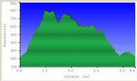
Elevation profile of the walk - it's got up and down bits!

The route as mapped by my GPSr

The route viewed in 3D using Google Earth.
The start and finish point is at the far right.
We worked anti-clockwise.
We drove back down to the village of Coniston and for a final flourish took a group photo for a webcam cache (our 20th cache and last of the day) before Mr. Truffles kindly bought us all a much needed celebratory pint. An hour's chatting, more shaking of hands and slaps of backs and then we all mostly went our own ways.

Webcache photo
Five of us remained for a further night. We met up for food at seven but I can tell you it was significantly more subdued than the previous evening and after food and a lemonade I was back at my B&B for 10pm watching TV and ready for a sleep!
All in all an absolutely fantastic weekend. I hope to do it more often and even now, three days later, I'm still buzzing from the experience.
Thank you to ALL that attended for making it the event it was.
Incredible.
Saturday morning 19/03/2011 Coniston.
After a drunken night's sleep and being repeatedly awoken through dehydration, toilet visits, headache tablets and a faulty B&B alarm clock, I finally awoke at the correct time of 7:30 and went downstairs for my English breakfast.
I felt surprisingly well, ate my food, booted up and walked the short distance into town to meet the forming flock at the tourist information car park.
Waiting there for people to arrive I quickly realised I was struggling to stand up straight without wobbling - the reason I was feeling reasonably OK was because I was still drunk. The merciless, and deserved, teasing started here and continued throughout the day and evening.
I then got a lift in Patrick's van up to the Walna Scar Road car park. Here we waited and met up with everyone else.
Roll call
(In no particular order and with Geocaching usernames.)
Ernie (Mr. Truffles) - his event, his soon-to-be 10,000th cache.
Mike (MikeG) - flag carrier (for the peak and for photos.)
Steve (StevieP)
Patrick and Donna (Patdhill) and Dizzy the dog.
Dave and Sue (The Black Pigs) and Brook the smelly caching dog (their words, not mine.)
Paul (Penfolio)
Gary (Bleaklow)
and me Mark (Aggrajag)
We started with a gentle walk along the Walna Scar Road heading towards the Boo Tarn path that we were going to take up to the summit of Coniston Old Man but tragically I remember very little of the first hour. My lungs felt like I was eighty, I was wheezing, my heart was pounding and I was perpetually thirsty. I'd taken tablets and had two litres of water on me for the day, so I was prepared - but my body wasn't.
Within twenty minutes I thought I would die here. I honestly couldn't cope, even taking it all one-foot-in-front-of-the-other I could see I'd not make it to the first plateau nevermind the summit. Why on Earth did I drink so much the previous night?
Ernie encouraged me and told me to take my time, along with another couple who were struggling, and to keep plodding on steadily each time the group stopped to find and sign a cache. I mostly did this and for this reason didn't even see the first five caches.
We headed up and up and up, in beautiful weather with clouds around the peaks, and slowly my body started to work. Like a seized up engine slowly easing free my lungs expanded and performed more quietly so my breathing was far less laboured, my joints loosened and my pounding heart slowed to a steady pace. Continually sipping water from my platypus I gradually felt better although I did take another couple of painkillers about 10:30am for a headache I could feel creeping in.
During one of my 'keep on walking' phases I missed a turning, or to quote someone I "zagged instead of zigged" and ended up a good way off course. Determined at all costs not to walk downhill and waste any energy already spent I mountain-goated it along a non-path towards a potential rendezvous point and consequently completely missed the third cache by about a 70 foot elevation.

Some distance up the mountain
Between the third and fifth cache I was fooled by a couple of false peaks. Maybe it was just delusional hope but it's soul destroying to come over the brow of a hill to see another three in front of it.


Further up the mountain and looking to Coniston Water
We all grouped up at the fifth cache (Geocache link: Peek a Boo 5) ready for the final push; the steepest part of the walk and the last leg before the summit. I was feeling even better so set off second behind Mr Truffles who had got a burst of 'Truffle power' because the next cache would be his 10,000th.
A really arduous walk to the top, I was easily overtaken by Bleaklow, but was pleased to eventually arrive third and joyously congratulated Mr T on his epic landmark - 10,000 caches! - it really puts my 700 into perspective.
It was now 10:50, only 100 minutes into the expedition yet amazingly 1,800 feet higher than the start with us now being at an altitude of 2,550 feet.
Everyone arrived and we celebrated with champagne and chocolate truffles from the main man himself, and also parkin provided by the Black Pigs. (Personally I would have sold my children at this point, had I got them with me, for a cup of coffee.) MikeG constructed his Yorkshire flag and we took many photos of the group and the fantastic views all around us - including 'Low Water' 700 feet directly below us. We even sang 'Happy 10,000 to you' to the tune of Happy Birthday. It was bitterly cold, now exposed to the wind, and there were even patches of snow around but we stopped for 30 minutes before heading off North towards Brim Fell.

Mr. Truffles bags his 10,000th cache
(Also note snowball made by Bleaklow)

Mr. Truffles being congratulated by flag carrier MikeG

A view from the peak down to Low Water - a deceiving 700 feet below
(Please note that my pictures today were taken by a simple point and shoot Kodak digital camera. Distance does not show itself in these pictures and the lighting is also pretty poor in some of them.)
A long flat walk, rising only 30 feet over the next half a mile we soon arrived at the highest point of our day at 2,587 feet - the peak of Brim Fell. Heading South-West we made a long descent to a dip between Brim Fell and Dow Crag and here we stopped for lunch in a lovely sheltered location affording us fantastic views towards the rocky mountaineering sides of Dow Crag. Time to eat, take some more pictures and also have a play with my binoculars.

Looking at Dow Crag
From this lower point of 2,100 feet we then walked steadily up to the peak of Dow Crag arriving at 12:30 and now at about 2,470 feet. Hard going again as I had food sitting uncomfortably inside me - nothing to do with alcohol or the side effects, just simply a lump of food in the way. Otherwise I was feeling fantastic.
Here some of us (not me I confess) found A Window on Dow Crag (Geocache link) which is a hard cache overlooking very steep cliffs. Here there is a stone rested on another stone leaving a 'window' in the mountain. All much too scary for me.

StevieP following Mr. Truffles to 'The Window'
From here a long gentle walk South through bitterly cold blowing fog towards Brown Pike peaking at 2,120 feet. The clouds were very strange for although you could see them blowing past you merely five feet away you could still see tremendously long distances. It was like fog in reverse.
By this point I was full of energy and feeling fit as a fiddle albeit, of course, with tired legs.
From here we headed South West on a long, but easy, dog leg to pick up a couple of unrelated caches. The first half was tricky, rocky paths but the second half was lovely flat grass and was a welcome relief on the ankles.
An about turn and most of the way back to Brown Pike stopping short and heading off East across the Southern face of it before turning North and heading along the East face towards a natural wonder (in my eyes) - Blind Tarn. This is a beautiful natural lake invisible from all sides except from Brown Pike above; crystal clear water fills a genuinely tranquil hidden oasis. We all stopped to admire it's beauty for fifteen minutes or so.

A view from above taken much earlier

A Mediterranean Oasis? Nah, it's near frozen

The same with the sun hiding
Back to the path on the South face of Brown Pike and then a long hard trek East along a stony and rocky path until we arrived, knees aching, at a stone bridge over a small beck. I found this rather strange as it was the first sight of civilisation we'd had for several hours and seemed rather at odds with the surroundings. From here we could also see through the reverse side of 'The Window' way, way up the hills back at Dow Crag to our North North West. Another peek through the binoculars to see it much closer.
The end now in sight we decided to divert once more to pick up another cache at a disused quarry south of the track we were on. Leaving rocky tracks we thankfully started walking on grass again and soon arrived at a man-made wonder. A beautiful waterfall hidden in what appears to be an abandoned slate quarry (I could be wrong.) The pictures do not do the light justice.

Abandoned quarry

A different view
Heading back North to the original track again (and having to regain lost height much to the chagrin of certain members) we soon arrived back at the track and then made the final push North East then East back towards the car park only stopping for a quick look at some rocks to fulfil the requirements of an Earthcache (and educate ourselves) and also a group photo for the same reason.

From L-R: Sue, Dave, Brook the Dog, MikeG, Bleaklow, StevieP, Penfolio, Yours truly, Patdhill, Dizzy the Dog and Mr. Truffles.
Thanks to Donna for taking the photo.
We arrived back at the cars, weary and aching, at 15:30 having been out for six and a half hours and having walked/climbed/struggled through nine miles of mountains atop five peaks - Old Man of Coniston, Brim Fell, Dow Crag, Brown Pike and White Maiden.

Elevation profile of the walk - it's got up and down bits!

The route as mapped by my GPSr

The route viewed in 3D using Google Earth.
The start and finish point is at the far right.
We worked anti-clockwise.
We drove back down to the village of Coniston and for a final flourish took a group photo for a webcam cache (our 20th cache and last of the day) before Mr. Truffles kindly bought us all a much needed celebratory pint. An hour's chatting, more shaking of hands and slaps of backs and then we all mostly went our own ways.

Webcache photo
Five of us remained for a further night. We met up for food at seven but I can tell you it was significantly more subdued than the previous evening and after food and a lemonade I was back at my B&B for 10pm watching TV and ready for a sleep!
All in all an absolutely fantastic weekend. I hope to do it more often and even now, three days later, I'm still buzzing from the experience.
Thank you to ALL that attended for making it the event it was.
Incredible.
Thursday, 13 January 2011
Overton - take 2
Pushing to use up some unspent 2010 holidays I took today off and headed solo up to Overton once more. I came here, goodness me it's nearly a month ago, to do the Reindeer Roundabout Ramble series - it was sub-zero, windy and therefore bitterly cold.
Well what a difference a month has made - I might still have been taking two steps forwards and one step back but this time it was because of the mud and not the solid ice. It was +12 degrees centigrade (at 10:00 am, much more by midday) as opposed to -4 degrees last time.
I parked at the Reindeer Inn again, a favoured haunt of MikeG the series owner I believe, and set off on a 4.2 mile jaunt picking up 16 caches on the way. Most of the caches were quick and easy finds which, for me, makes the walk much more fun and this truly was a fabulous walk set in lovely countryside; sun, warm air, plenty of wildlife (squirrels, pigeons, grouse) and also domestic animals (dogs, cows, horses) and generally up hill and down dale through mud, mud and more mud.
Lots of mud. I've got home and I'm caked to my knees where it's splashed up both the front and back.
What a great day! And it's not even over...
I returned to the Reindeer, had a drink and some nice lunch in there then moved the car half a mile down the road and started another smaller series. I had a couple of frustrating did-not-finds on this walk, and the mud was unbelievably even worse, but I felt great after it - likely because of the walk up wet farmer's fields making me work hard.
This walk was 2.4 miles and bagged another 5 caches bring the day's total to 6.6 miles and 21 caches.
PS. I genuinely think that in the height of summer this first series "Denby Delights 2010" (plus a few extras en-route) will probably be one of the best cache walks there is. In the thick mud today, suitably equipped of course, I still rate it as one of my best ever. Thanks Mike.
Well what a difference a month has made - I might still have been taking two steps forwards and one step back but this time it was because of the mud and not the solid ice. It was +12 degrees centigrade (at 10:00 am, much more by midday) as opposed to -4 degrees last time.
I parked at the Reindeer Inn again, a favoured haunt of MikeG the series owner I believe, and set off on a 4.2 mile jaunt picking up 16 caches on the way. Most of the caches were quick and easy finds which, for me, makes the walk much more fun and this truly was a fabulous walk set in lovely countryside; sun, warm air, plenty of wildlife (squirrels, pigeons, grouse) and also domestic animals (dogs, cows, horses) and generally up hill and down dale through mud, mud and more mud.
Lots of mud. I've got home and I'm caked to my knees where it's splashed up both the front and back.
What a great day! And it's not even over...
I returned to the Reindeer, had a drink and some nice lunch in there then moved the car half a mile down the road and started another smaller series. I had a couple of frustrating did-not-finds on this walk, and the mud was unbelievably even worse, but I felt great after it - likely because of the walk up wet farmer's fields making me work hard.
This walk was 2.4 miles and bagged another 5 caches bring the day's total to 6.6 miles and 21 caches.
PS. I genuinely think that in the height of summer this first series "Denby Delights 2010" (plus a few extras en-route) will probably be one of the best cache walks there is. In the thick mud today, suitably equipped of course, I still rate it as one of my best ever. Thanks Mike.
Wednesday, 29 December 2010
Reindeer Ramble
17/12/10 - After the stress of work the last few weeks I insisted on a day off to finish my Christmas shopping. I took this opportunity to get in and out of Meadowhell as fast as possible and to then do some solo caching in the peace and quiet of open countryside.
I had chosen to do the Reindeer Roundabout Ramble series near Overton, a village 20 mins up the motorway. This is a short walk of around 4 miles starting and ending at the Reindeer Pub near the National Coal Mining Museum.
I arrived at midday and quickly set off south down the road looking for the path off to the left heading east. It was bitingly cold, extremely frosty, with all the puddles frozen solid but I thought I'd be OK. After all I had a flask of tea!
I was stressed from work and I was stressed from Christmas shopping so I was hoping to 'come down' as I walked around.
I was at the first cache within 10 minutes and then the problems began. I simply couldn't find this cache and the hint was being no help. I phoned-a-friend (PAF) to no avail. I'd forgotten my hat, my batteries ran out and I had to keep taking off my gloves to use my iPhone for calling and also searching previous logs for information that might help. It was BITTERLY cold and the driving wind was of course making things much worse.
So it was starting to look pretty grim but THANKFULLY I found the little bugger. It was a test-tube style container hidden in the crack of a tree which was perfectly covered up by a blob of ice.
Change of batteries. Still stressed. Deep breath. Try to chill out (mentally not physically, that was already happening) and onwards.
The next two caches were thankfully really easy although again I was really exposed to the wind. The fourth was tricky as it was hidden under a stone I couldn't even see - it was frozen into the ground under the grass but luckily I tripped on it after about 15 minutes of looking.
An easy one and then one I was convinced had been Muggled. I PAF Patrick again and he tried to recall the cache but nothing rang any real bells. Fortunately I'd been misled by a pile of stones and somehow, I never figured out how, I found the cache stuck in a little hole half the size of the cache and covered with a clump of dead grass. I couldn't replace it similarly so had to resort to putting it under the stones 6" away. Freezing cold I stopped for a cuppa.
The walk now moved away from fields onto a tree lined track which afforded me some protection from the elements and as a bonus the sun was also peeking out - although it was guaranteed nothing was going to melt today except my stress which was starting to fade.
The next cache was at the side of the track, down a ledge and under a tree. I'd not seen one single solitary soul in the two hours since I'd started and as I stepped up onto the track it must have looked as though I was trying to abduct this poor female horserider. The horse reared up only marginally higher than I did as my feet got even colder temporarily leaving my boots. I apologised but I think she'd lost her voice, or her bowels.
We trotted off in separate directions both no doubt adrenalised by the experience and two minutes later I bumped into, it transpired, her friend leading a pony. She asked me if I'd lost my dog as one had been running wild nipping at her pony. We got chatting about the area, Christmas, the weather and her friend with the newly found heart murmur further up the track.
The next cache was a tricky one, frozen and camouflaged as it was into the mud, and it wasn't until logging it later that evening that I noticed the two previous loggers had logged a DNF (did-not-find) - it's a good job I'd not noticed these or I'd likely have given up searching.
The 'pony girl' returned and we chatted for another 10 minutes before our paths separated.
Now into woods and on the way back there's little of interest to note as I found the next three. I then couldn't find the last of the series certain it had been Muggled and finally I had to PAF Patrick again as like a wally I'd forgotten the clues from the first three caches of the day to get the final mystery cache.
A mile back to the final (thanks for the coords Patrick) and then another quarter mile back to the car - too late to get a sneaky pub lunch.
Total for the day was 3.8 miles walked, 14 finds, 1 DNF, frostbite and a tiny heart attack.
(Thanks must go to MikeG for the series and the two randoms I picked up en-route.)
I had chosen to do the Reindeer Roundabout Ramble series near Overton, a village 20 mins up the motorway. This is a short walk of around 4 miles starting and ending at the Reindeer Pub near the National Coal Mining Museum.
I arrived at midday and quickly set off south down the road looking for the path off to the left heading east. It was bitingly cold, extremely frosty, with all the puddles frozen solid but I thought I'd be OK. After all I had a flask of tea!
I was stressed from work and I was stressed from Christmas shopping so I was hoping to 'come down' as I walked around.
I was at the first cache within 10 minutes and then the problems began. I simply couldn't find this cache and the hint was being no help. I phoned-a-friend (PAF) to no avail. I'd forgotten my hat, my batteries ran out and I had to keep taking off my gloves to use my iPhone for calling and also searching previous logs for information that might help. It was BITTERLY cold and the driving wind was of course making things much worse.
So it was starting to look pretty grim but THANKFULLY I found the little bugger. It was a test-tube style container hidden in the crack of a tree which was perfectly covered up by a blob of ice.
Change of batteries. Still stressed. Deep breath. Try to chill out (mentally not physically, that was already happening) and onwards.
The next two caches were thankfully really easy although again I was really exposed to the wind. The fourth was tricky as it was hidden under a stone I couldn't even see - it was frozen into the ground under the grass but luckily I tripped on it after about 15 minutes of looking.
An easy one and then one I was convinced had been Muggled. I PAF Patrick again and he tried to recall the cache but nothing rang any real bells. Fortunately I'd been misled by a pile of stones and somehow, I never figured out how, I found the cache stuck in a little hole half the size of the cache and covered with a clump of dead grass. I couldn't replace it similarly so had to resort to putting it under the stones 6" away. Freezing cold I stopped for a cuppa.
The walk now moved away from fields onto a tree lined track which afforded me some protection from the elements and as a bonus the sun was also peeking out - although it was guaranteed nothing was going to melt today except my stress which was starting to fade.
The next cache was at the side of the track, down a ledge and under a tree. I'd not seen one single solitary soul in the two hours since I'd started and as I stepped up onto the track it must have looked as though I was trying to abduct this poor female horserider. The horse reared up only marginally higher than I did as my feet got even colder temporarily leaving my boots. I apologised but I think she'd lost her voice, or her bowels.
We trotted off in separate directions both no doubt adrenalised by the experience and two minutes later I bumped into, it transpired, her friend leading a pony. She asked me if I'd lost my dog as one had been running wild nipping at her pony. We got chatting about the area, Christmas, the weather and her friend with the newly found heart murmur further up the track.
The next cache was a tricky one, frozen and camouflaged as it was into the mud, and it wasn't until logging it later that evening that I noticed the two previous loggers had logged a DNF (did-not-find) - it's a good job I'd not noticed these or I'd likely have given up searching.
The 'pony girl' returned and we chatted for another 10 minutes before our paths separated.
Now into woods and on the way back there's little of interest to note as I found the next three. I then couldn't find the last of the series certain it had been Muggled and finally I had to PAF Patrick again as like a wally I'd forgotten the clues from the first three caches of the day to get the final mystery cache.
A mile back to the final (thanks for the coords Patrick) and then another quarter mile back to the car - too late to get a sneaky pub lunch.
Total for the day was 3.8 miles walked, 14 finds, 1 DNF, frostbite and a tiny heart attack.
(Thanks must go to MikeG for the series and the two randoms I picked up en-route.)
Subscribe to:
Posts (Atom)